 ar
ar bg
bg hr
hr cs
cs da
da nl
nl fi
fi fr
fr de
de el
el hi
hi it
it ko
ko no
no pl
pl pt
pt ro
ro ru
ru es
es sv
sv tl
tl iw
iw id
id lv
lv lt
lt sr
sr sk
sk sl
sl uk
uk vi
vi et
et hu
hu th
th tr
tr fa
fa ms
ms hy
hy ka
ka ur
ur bn
bn mn
mn ta
ta kk
kk uz
uz ku
ku
water gauge level
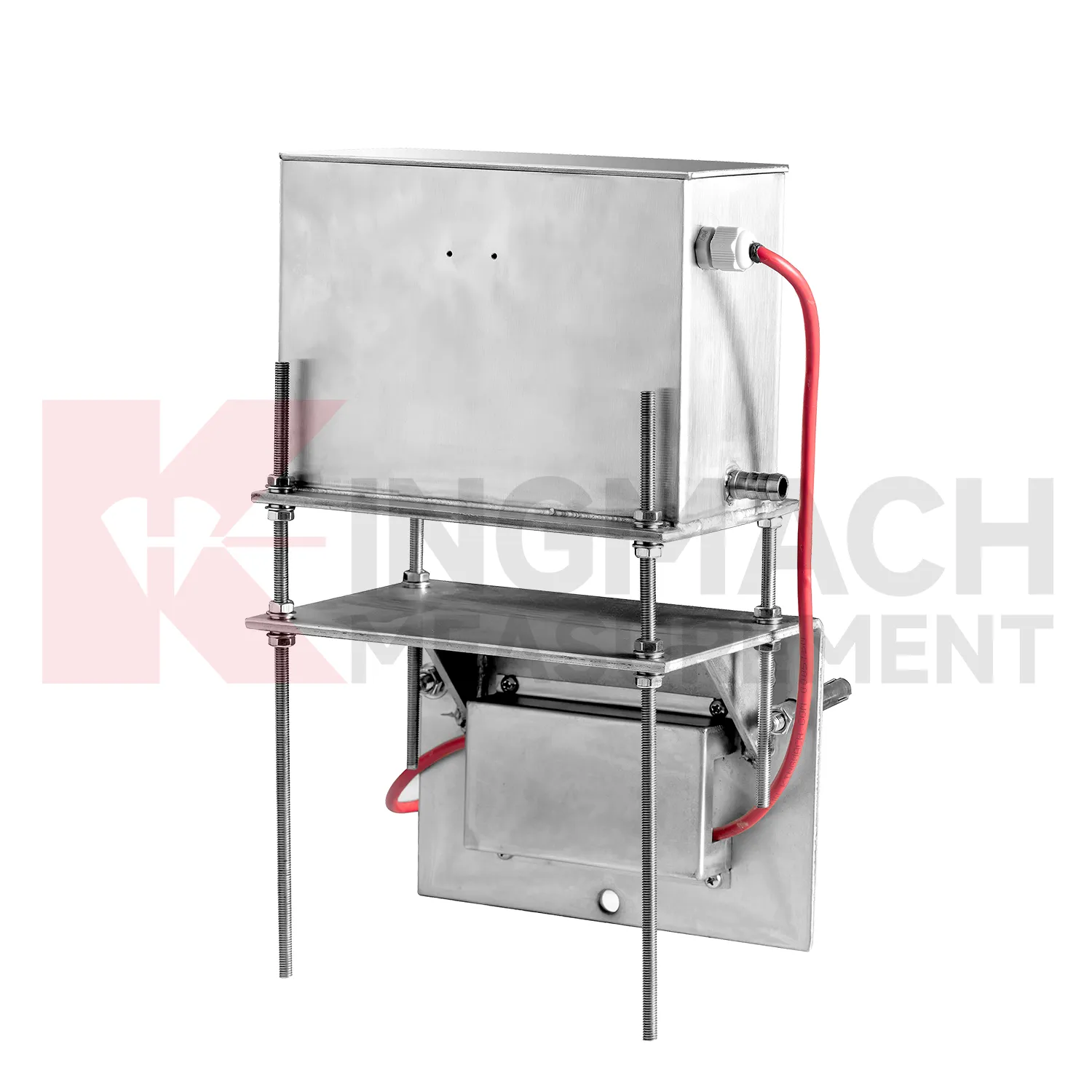
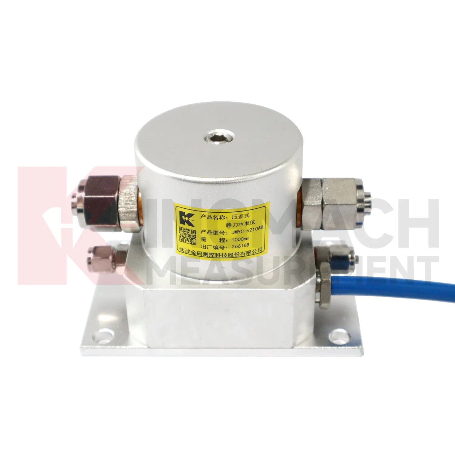
The JMYC-62XXAD wide-range differential pressure hydrostatic level sensor extends Kingmach water gauge level into projects where settlement may be too large for micro range instruments. It works as a reference-point hydrostatic system for uneven pavement settlement, nonlinear cross-section settlement, soft foundation treatment, land reclamation foundations, dam settlement, bridge deflection, slope stability, and building settlement. Published specifications include 500 mm, 1000 mm, 2000 mm, and 4000 mm ranges, 0.1 mm resolution, 0.2%FS accuracy, RS485 output, DC 9V to 24V supply, power consumption below 0.5W, and an operating temperature from -30 degrees Celsius to +80 degrees Celsius. The instrument is especially relevant when a profile may keep moving during filling, preloading, or staged construction. Planning should define the fixed reference point first, then divide the section into measuring locations that can reveal uneven deformation. Cable protection, cabinet access, sensor elevation, and construction vehicle paths need early coordination. When the data is reviewed later, the wide range helps distinguish gradual consolidation from sudden local movement across a road, reclamation area, or embankment section.
Application of water gauge level
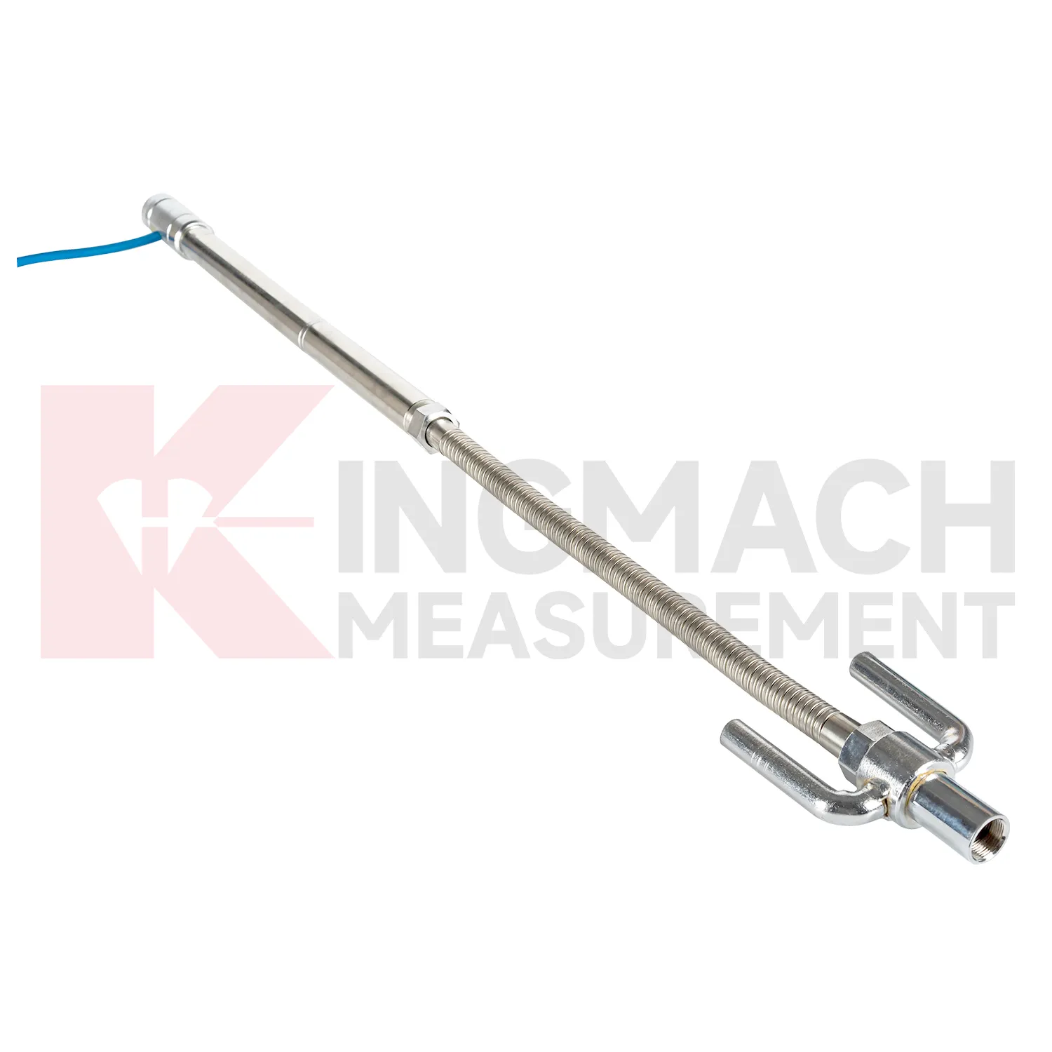
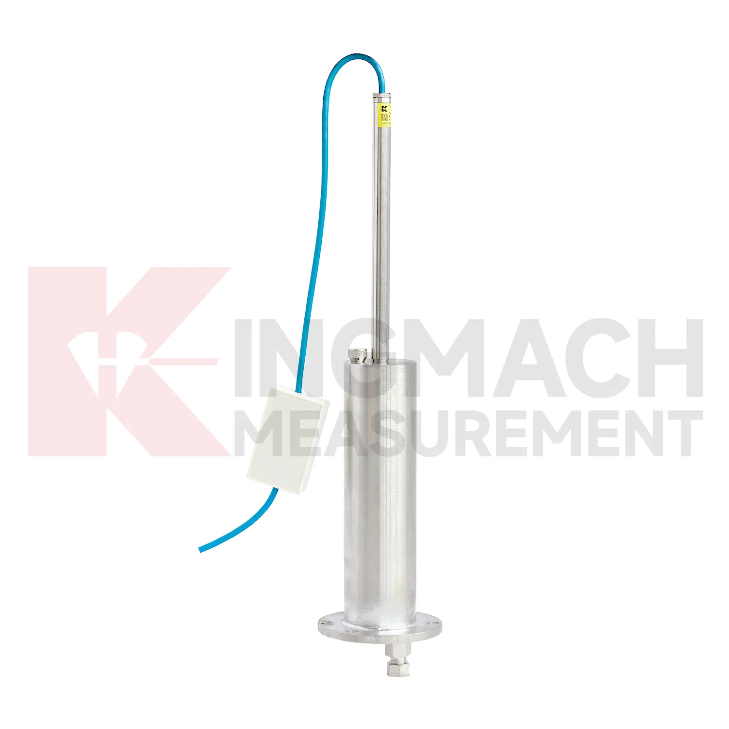
Pile foundations, dykes, and embankments use water gauge level to verify vertical response during loading, filling, or long-term service. Kingmach JMDL-47XXAT is described for pile foundation settlement, dyke compression deformation, embankment heave, roadbed settlement, and base uplift in deep foundation pits. Its assembly includes a settlement plate, electrical displacement sensor, measuring rod with metal flexible conduit, anchor head, extension rod, and bottom anchor head. Published range options are 100 mm, 200 mm, 300 mm, and 400 mm, with gauge lengths from 760 mm to 2210 mm. Because the sensor is embedded, the installation record is almost as important as the reading itself. Crews should document depth, plate position, rod connection, cable exit, protection method, and nearby fill material before the location is covered. During loading, the curve can be checked against fill height, pile test stage, water condition, and surface survey marks. The side-exit cable arrangement helps reduce interference during pavement compaction, which is useful when monitoring must continue as construction equipment passes over the area.
The future of water gauge level
Future water gauge level will be specified as part of mixed monitoring packages. Settlement alone may show that a point moved downward, but it rarely explains the cause. A railway subgrade package may combine settlement gauges, rainfall, pore pressure, tilt, and vibration. A bridge package may combine hydrostatic settlement, strain gauges, load cells, temperature, and deflection readings. A foundation pit package may combine single-point settlement, groundwater level, retaining wall displacement, and support force. Kingmach already has product groups across settlement, displacement, strain, load, tilt, environmental monitoring, acquisition hardware, cables, and software. The next practical improvement is selecting the settlement product together with the logger, cabinet, communication route, warning levels, and inspection actions. This lets the monitoring network answer a site question instead of producing separate curves that must be interpreted after the fact.
Care & Maintenance of water gauge level
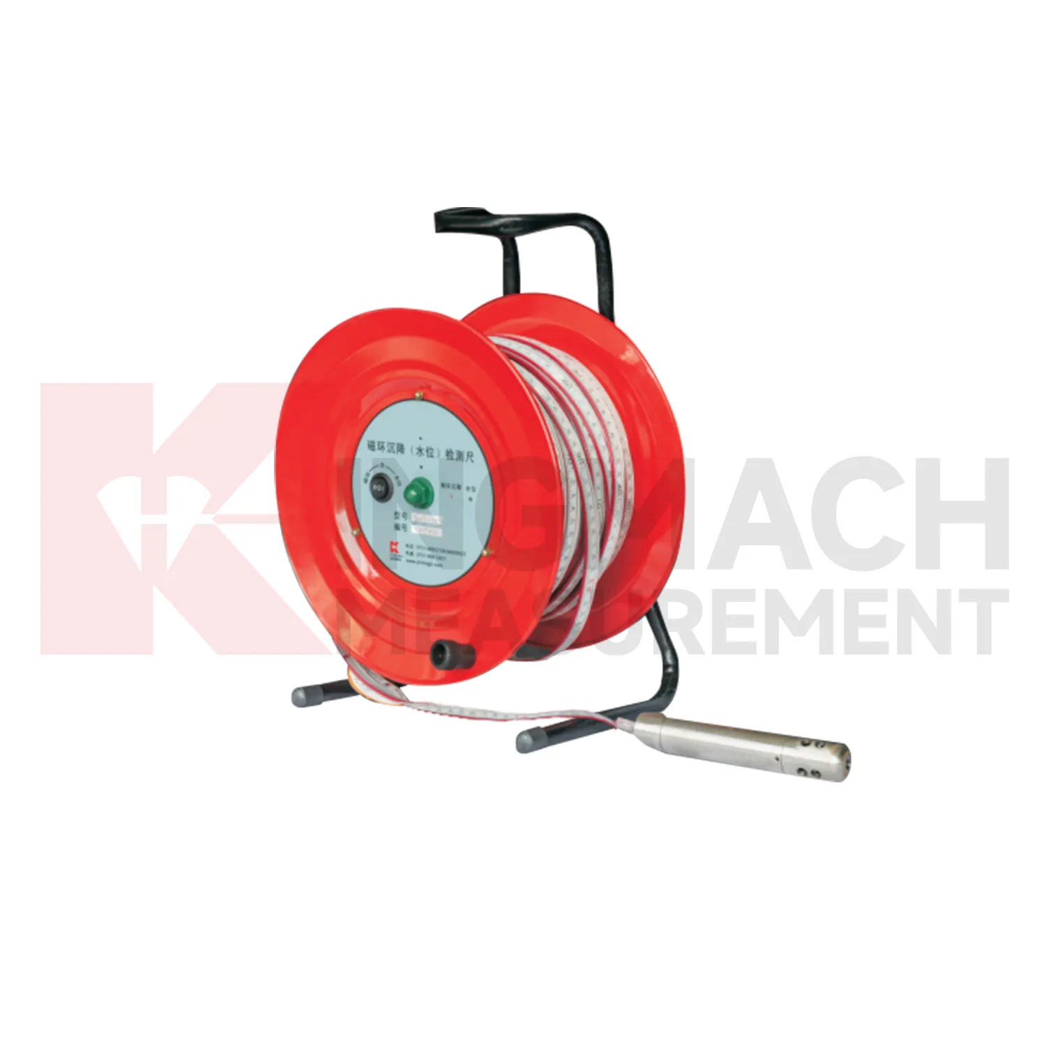
Manual-reading water gauge level should follow a repeatable procedure every visit. Use the same reference mark, reading direction, tape handling method, waiting time, and data sheet format. This is especially important for magnetic ring settlement gauges and borehole water level readings, where inconsistent field practice can create false changes. Record operator, weather, groundwater condition, borehole obstruction, battery condition, and any unusual sound or visual indication from the alert system. Do not round readings differently from one visit to the next. If manual data is later entered into software, keep the original field notes available for checking. Manual monitoring can be reliable over many years when the process is simple, dated, and boringly consistent. The goal is repeatability, not speed.
Kingmach water gauge level
Wide-area settlement monitoring needs water gauge level that can handle larger travel and uneven profiles. Kingmach JMYC-62XXAD wide-range differential pressure hydrostatic level sensors are designed for pavement settlement, cross-sectional nonlinear settlement, soft foundation treatment, land reclamation foundations, dam subgrades, slope stability, bridge deflection, and building settlement. The listed range extends from 500 mm to 4000 mm, with 0.1 mm resolution and 0.2%FS accuracy. This makes it different from micro range sensors used for smaller deflection changes. A long road or reclamation section should not be judged by one point only. The value comes from comparing a profile over time, then linking that profile with filling stage, surcharge timing, drainage records, groundwater, and site inspection notes. This is especially important when several instruments share one cabinet or when hydrostatic tubes, embedded rods, and manual borehole readings appear in the same project. This is especially important when several instruments share one cabinet or when hydrostatic tubes, embedded rods, and manual borehole readings appear in the same project.
FAQ
Q: How should water gauge level be maintained?
A: Check reference points, tubes, cables, seals, settlement plates, anchors, probes, cabinets, and channel names at planned intervals.
Q: Should zero values be reset casually?
A: No. A reset can hide real settlement. If a reset is necessary, record the reason, time, old baseline, and new baseline.
Q: What data should be reviewed with settlement?
A: Rainfall, groundwater, excavation depth, filling stage, traffic loading, tilt, displacement, strain, and load data can all help explain settlement changes.
Q: What signs suggest a data issue?
A: Flat lines, sudden jumps after maintenance, impossible values, repeated communication gaps, or disagreement with nearby points may indicate instrument or data-chain problems.
Q: What makes a settlement report useful?
A: A useful report includes point location, model, range, baseline, reference point, latest reading, cumulative settlement, rate of change, and field notes.
Reviews
Robert Taylor
The weir flow meter is well-built and delivers accurate measurements. Great value for water management applications.
Daniel Brown
Excellent environmental monitoring sensors. The data is consistent, and the system integrates smoothly with our existing setup.
Latest Inquiries
To protect the privacy of our buyers, only public service email domains like Gmail, Yahoo, and MSN will be displayed. Additionally, only a limited portion of the inquiry content will be shown.
Olivia***@gmail.comUnited States
Hello, we are currently sourcing high-precision strain gauges and load cells for a bridge monitoring...
Amelia***@gmail.comSingapore
Hello, I am looking for visualization software for monitoring system data analysis. Please let me kn...
Related product categories
- water level gauge
- water gauge water level gauge
- water gauge level
- gauge water level
- Magnetic Ring Settlement Water Level Gauge
- Optical Deflection Monitor
- Tilt Sensor
- Deflectometer
- Micro Range Hydrostatic Level Sensor
- Single-point Settlement Meter
- Optical Deflection Monitor
- Inclinometer-based Hydrostatic Leveling System