 ar
ar bg
bg hr
hr cs
cs da
da nl
nl fi
fi fr
fr de
de el
el hi
hi it
it ko
ko no
no pl
pl pt
pt ro
ro ru
ru es
es sv
sv tl
tl iw
iw id
id lv
lv lt
lt sr
sr sk
sk sl
sl uk
uk vi
vi et
et hu
hu th
th tr
tr fa
fa ms
ms hy
hy ka
ka ur
ur bn
bn mn
mn ta
ta kk
kk uz
uz ku
ku
wireless tiltmeter
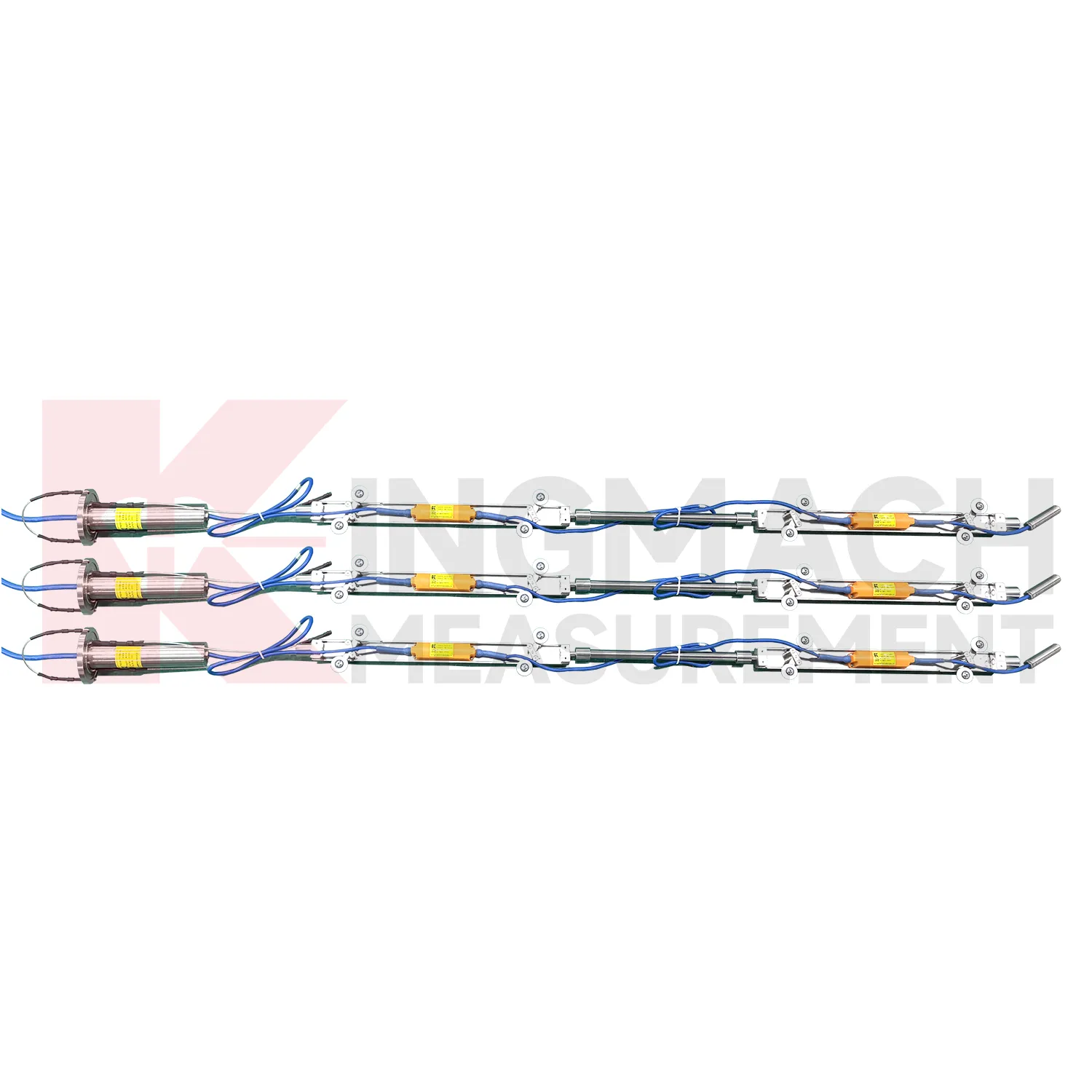
The JMQJ-7915ATS vertical in-place inclinometer system gives Kingmach wireless tiltmeter a multi-point downhole monitoring method. The system consists of a multi-point tandem inclinometer string and an orifice acquisition module. Multiple MEMS inclination sensors are electrically connected through a single cable inside the borehole, while universal joints and connecting rods arrange measuring points according to design spacing. The system can divide sensors into up to four independent communication groups, uses automatic temperature compensation, and includes electronic identifiers for automatic recognition and intelligent calculation. Published specifications include dual-axis +/-90 degrees tilt range, 0.001 degree resolution, 0.01 degree accuracy, DC 9V to 24V operating voltage, power consumption below 0.2W, single-wire uplink communication at 1200 bps, -30 degrees Celsius to +70 degrees Celsius operating temperature, 0.35 m guide wheel spacing, about 0.8 kg weight, and IP68 protection.

Application of wireless tiltmeter
Integrated monitoring platforms use wireless tiltmeter as the angular deformation layer in a broader site record. A project may combine fixed tilt sensors, in-place inclinometer strings, displacement meters, settlement gauges, load cells, strain gauges, environmental sensors, data loggers, cables, and visualization software. Kingmach offers both tilt instruments and related acquisition products, so the monitoring plan can connect measuring points to platform channels from the beginning. The main task is to define which tilt point answers which site risk: wall rotation, pier movement, deep slope deformation, building lean, or tunnel lining response. Alarm levels should be based on that risk and reviewed with nearby instruments. When the platform displays tilt beside related data, engineers can judge linked behavior more quickly.
The future of wireless tiltmeter
The future of wireless tiltmeter will include stronger links to maintenance budgeting. Owners of bridges, railways, dams, tunnels, buildings, slopes, and towers need to rank which assets are stable and which require inspection or repair. Long-term tilt records can support that ranking when they are collected consistently and tied to structural locations. JMQJ-7315ADS, JMQJ-7315RTU, JMQJ-7915ATS, JMZX-7100L, and JMZX-4QH provide different paths for collecting angular or internal deformation data. Future asset systems can connect these records to inspection cycles, repair dates, weather events, and risk categories. The result is a tilt record that supports planning, not only construction-stage warnings.
Care & Maintenance of wireless tiltmeter
Replacement of wireless tiltmeter should preserve measurement continuity. When changing a fixed tiltmeter, integrated wireless unit, in-place string component, acquisition module, or sliding inclinometer accessory, record model, serial number, range, old reading, new reading, reason, date, technician, and any change to axis direction or channel name. Do not hide the replacement by forcing the new curve to look continuous without explanation. If a borehole string is reconfigured, update depth mapping and group communication records. If a wireless unit is replaced, check battery, antenna, and upload timing. A clear replacement record lets future engineers understand the curve and prevents maintenance work from being mistaken for structural deformation.
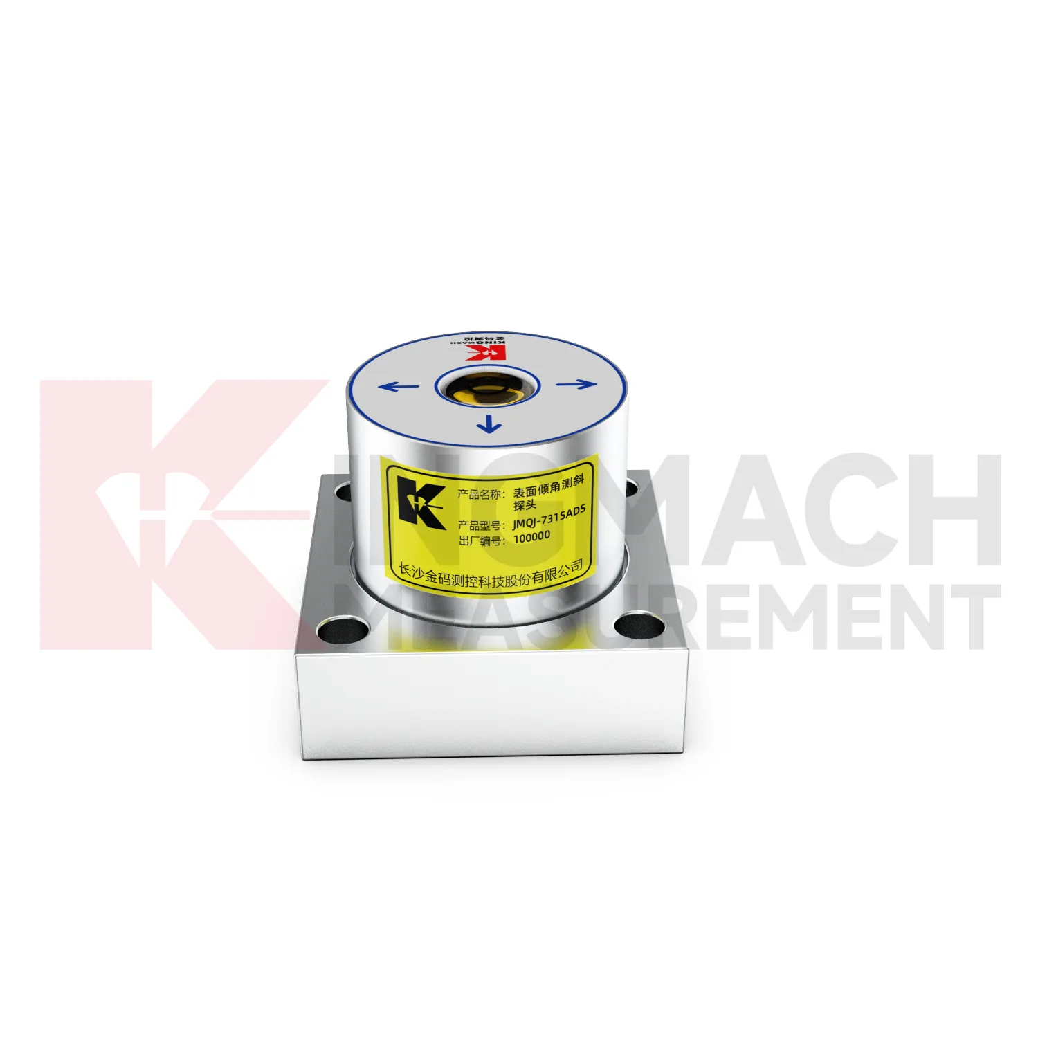
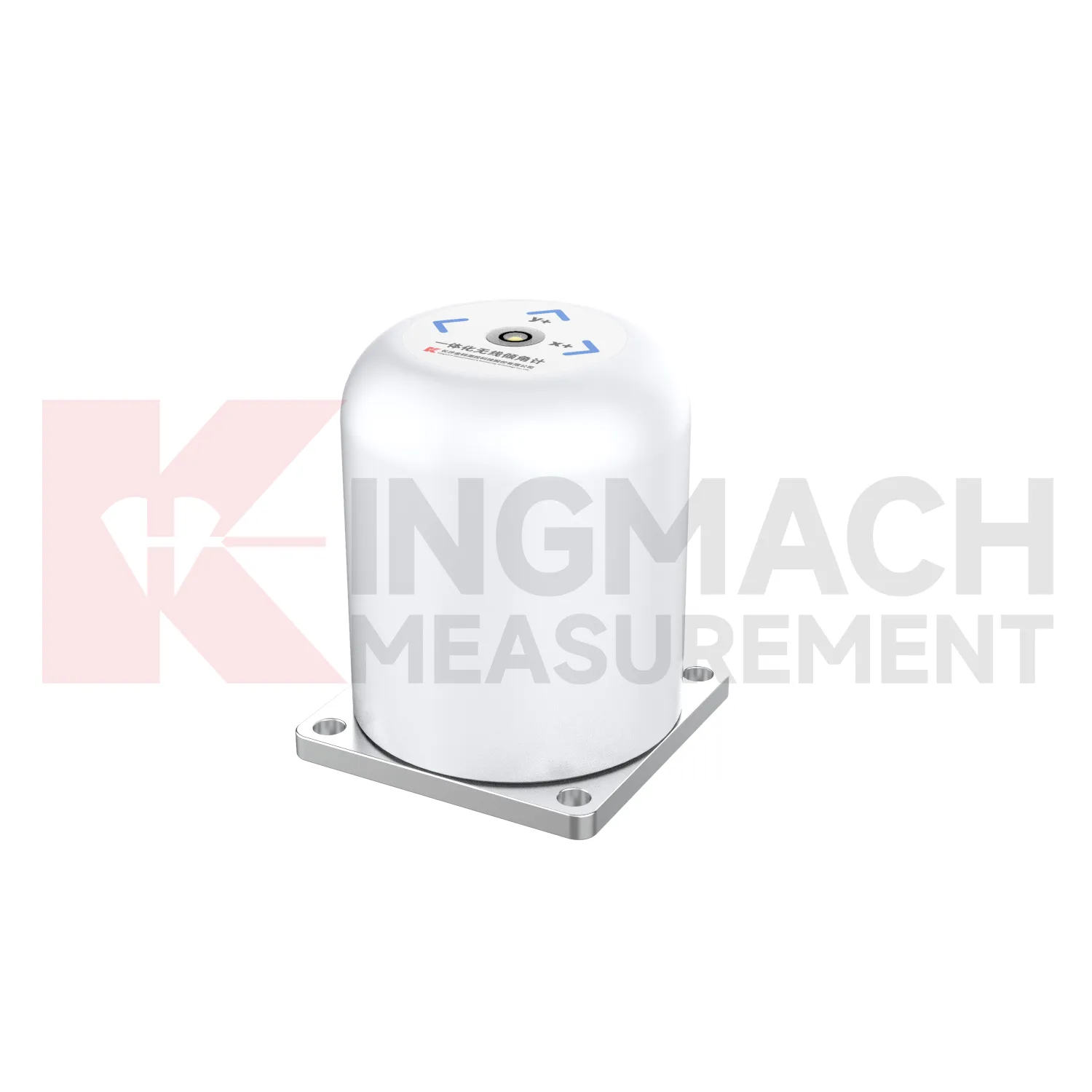
Kingmach wireless tiltmeter
Kingmach wireless tiltmeter support both surface structural tilt monitoring and deep internal deformation monitoring. Surface tilt instruments measure the angular change of buildings, bridges, railways, towers, walls, and equipment bases relative to the horizontal plane. Deep inclinometer systems, by contrast, follow angle changes inside soil or structural bodies through a borehole. The JMQJ-7915ATS vertical in-place inclinometer system uses a multi-array MEMS design, universal joints, connecting rods, and an orifice acquisition module to collect multi-point readings. This gives engineers a depth profile rather than one surface reading. That distinction is important in slopes, dams, embankments, foundation pits, and underground works. A surface point may remain calm while a deeper layer starts moving. Using the right tilt method makes the deformation pattern easier to locate.
FAQ
Q: How often should wireless tiltmeter be inspected?
A: Inspection frequency depends on risk, access, construction stage, and deformation speed; active excavation or storm periods often need closer review.Q: What maintenance is needed for wireless tilt units?
A: Check battery status, antenna condition, upload timing, enclosure seals, point label, and platform channel naming.Q: What causes false tilt changes?
A: Loose mounting, disturbed cables, water entry, temperature effects, power faults, channel mistakes, or inconsistent manual reading can affect the record.Q: How should replacement be handled?
A: Record old and new model, serial number, range, baseline, reason, date, axis direction, channel name, and first stable value after replacement.Q: What makes tilt data useful over many years?
A: Consistent point naming, stable baselines, clear installation photos, protected hardware, visible maintenance records, and comparison with related site data.
Reviews
Andrew Lee
The visualization software is intuitive and powerful. It helps us analyze monitoring data efficiently.
Daniel Brown
Excellent environmental monitoring sensors. The data is consistent, and the system integrates smoothly with our existing setup.
Latest Inquiries
To protect the privacy of our buyers, only public service email domains like Gmail, Yahoo, and MSN will be displayed. Additionally, only a limited portion of the inquiry content will be shown.
Sophia***@gmail.comUnited Kingdom
Good day, we need environmental monitoring sensors including temperature, humidity, and wind sensors...
Olivia***@gmail.comUnited States
Hello, we are currently sourcing high-precision strain gauges and load cells for a bridge monitoring...